From Satellite Data to Actionable Farm Decisions
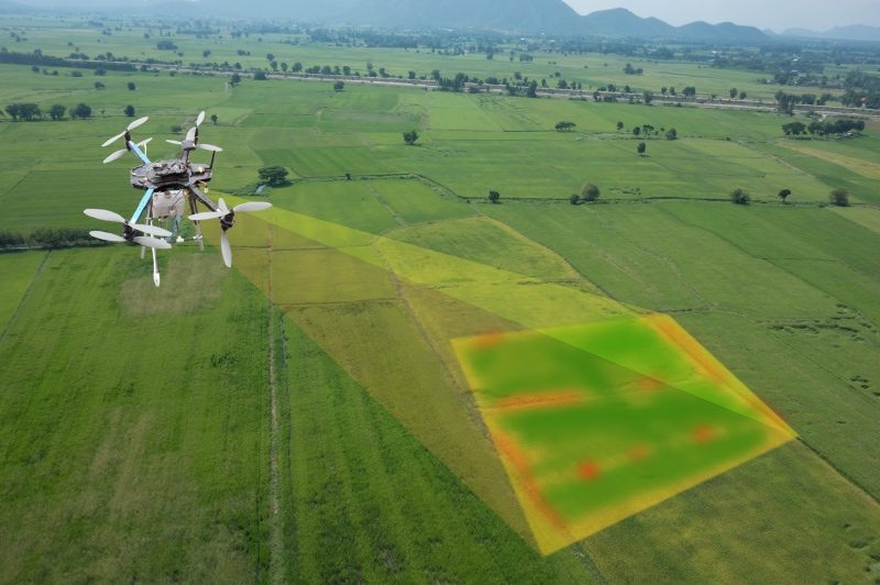
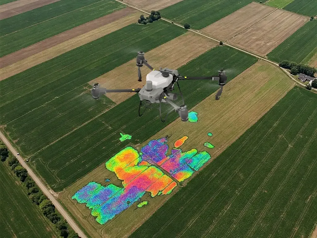
Akasha is CIDSA's integrated earth-observation platform — unifying satellite imagery, vegetation analytics, weather intelligence, GIS field mapping, AI crop analytics and advisory delivery into a single operating picture. Built for farmers, FPOs, research institutions and government programs — from field-level monitoring to region-scale agricultural planning.

NDVI 0.78
Healthy canopy
48 mm · 3 days
Rainfall forecast
Moisture stress
3 fields flagged
Built for the agricultural ecosystem
Relevant for institutions advancing digital agriculture
Akasha is designed to serve the full chain of stakeholders driving India's digital agriculture transformation — from research and extension to farmer collectives and institutional programs.
From raw imagery to crop-level and region-level decisions
Satellite data alone is not intelligence. Akasha converts multi-source earth observation, weather layers and field geometries into structured agricultural signals — monitoring, analytics, predictions and advisories — delivered through dashboards, reports and APIs built for agricultural institutions.
Observe
Multi-source satellite imagery, cloud-aware composites, and field geometries stream into Akasha continuously across the crop calendar.
Analyse
Vegetation indices, weather layers, and AI models translate raw pixels into crop-level signals — vigor, moisture, stress, phenology, yield.
Act
Analytics are converted into localized advisories, reports, and decision support for farmers, FPOs, and institutions.
Seven building blocks. One integrated platform.
Each Akasha capability can stand on its own — yet they compose into a single operating picture for digital agriculture. Below is how each block translates earth observation and field data into decisions.
Satellite Monitoring
Explore →Season-long eyes on every field
Track fields and regions across the full crop cycle with cloud-aware satellite observations, revisit-optimized composites, and a multi-year historical archive.
- Seasonal Kharif & Rabi crop monitoring
- Field-level and regional-scale imagery
- Multi-year historical scene archive
- Cloud-aware compositing for monsoon windows
Advanced Spectral Analysis
NDVI, NDWI, MSAVI, EVI, NDRE, LAI
Turn multi-spectral signatures into agronomic intelligence — crop vigor, canopy closure, moisture stress, nutrient deficits, and emergence patterns, index by index.
- Vigor and canopy assessment (NDVI / EVI / LAI)
- Moisture and irrigation stress (NDWI)
- Early emergence on sparse canopies (MSAVI)
- Red-edge nitrogen indicators (NDRE)
Weather Intelligence
Forecasts that become field decisions
High-resolution current conditions and forecasts integrated with rainfall trends and heat/frost risk — tuned for operational decisions on the farm.
- Current conditions & short-range forecasts
- Rainfall accumulation and deficit context
- Heat, frost & wind risk alerts
- Spray, irrigation & harvest decision windows
Water Management
Spatial water stress, field by field
Combine moisture indices with rainfall context to understand water stress spatially, prioritize irrigation, and plan resilient cropping strategies.
- Crop water stress mapping
- Irrigation prioritization by zone
- Drought pattern & rainfall deficit analysis
- Field-level water-use planning
AI Crop Analytics
Predictive signals from integrated data
AI models fuse imagery, indices and weather to deliver crop health scores, anomaly alerts, phenology stage detection and yield-estimation support.
- Crop health scoring & stress detection
- Phenology stage detection
- Yield-estimation support
- Pest & disease early-warning cues
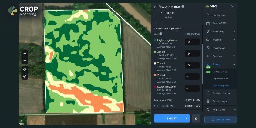
GIS Field Mapping
A digital foundation for every field
Create precise digital field boundaries, geotag records, and generate management zones — the geospatial backbone for monitoring, reporting and research.
- Digital field boundaries & geotagged records
- Crop-wise field inventory
- Management-zone generation
- Map-based monitoring & reporting layers
Advisory Dashboard
Insight delivered where it's needed
Convert analytics into crop-specific, localized recommendations and disseminate them to farmers, FPOs and extension teams via mobile and web.
- Region & crop-specific advisories
- Multilingual farmer communication
- FPO & institution group dashboards
- Mobile + web dissemination
One agricultural intelligence workflow, end to end
Field mapping, satellite imagery, vegetation analytics, weather intelligence, AI inference and advisory delivery are not siloed features in Akasha — they are stages of a single workflow that takes an institution from an empty map to an operational advisory system.
- Standardized field boundaries as the geospatial backbone
- Automated satellite & weather intake across seasons
- Indices & AI inference layered field-by-field
- Advisory generation with crop-specific rules
- Reporting & dissemination for teams and farmers
Akasha workflow
Map
Digitize fields, crops & zones
Monitor
Satellite & weather streams
Analyse
Indices, AI & agronomic rules
Advise
Localized recommendations
Act
Farm decisions & reporting
Agricultural use cases, mapped to Akasha capabilities
Akasha is deployed across a wide range of agriculture-first use cases — from farm-level monitoring to institutional planning and research workflows.
Crop Classification & Acreage Intelligence
Identify crop types at field and regional scale, quantify acreage, and build season-wise cropping maps for planning and policy support.
Explore capabilityCrop Health Monitoring
Continuous vigor and stress tracking across the crop cycle using NDVI/EVI/NDRE, with anomaly flags for early intervention.
Explore capabilityYield Estimation Support
Blend spectral trajectories, phenology and weather signals to build season-specific yield-estimation pipelines for paddy, wheat, and more.
Explore capabilityDrought & Water Stress Mapping
Spatialize water stress using moisture indices and rainfall deficits to prioritize relief, irrigation and resilience planning.
Explore capabilityKharif & Rabi Seasonal Monitoring
Season-specific monitoring dashboards tuned for Kharif and Rabi crops — from sowing progress to maturity and harvest windows.
Explore capabilityNutrient Stress & Anomaly Detection
Leverage red-edge and canopy indices to flag nutrient stress early, supporting precision fertilization and agronomic validation.
Explore capabilityRegional Advisory Dissemination
Push crop- and block-level advisories to farmers, FPOs and field staff via mobile and web, in regional languages.
Explore capabilityInstitution-Level Agricultural Planning
Give governments, boards and missions a common operating picture for cropping patterns, risk hotspots and season outcomes.
Explore capabilityFPO & Extension Support
Empower Farmer Producer Organisations and extension teams with collective dashboards, aggregated monitoring and group advisories.
Explore capabilityResearch & Validation Workflows
Export field- and plot-level time series, index trajectories and scene archives to power agronomic research and model validation.
Explore capability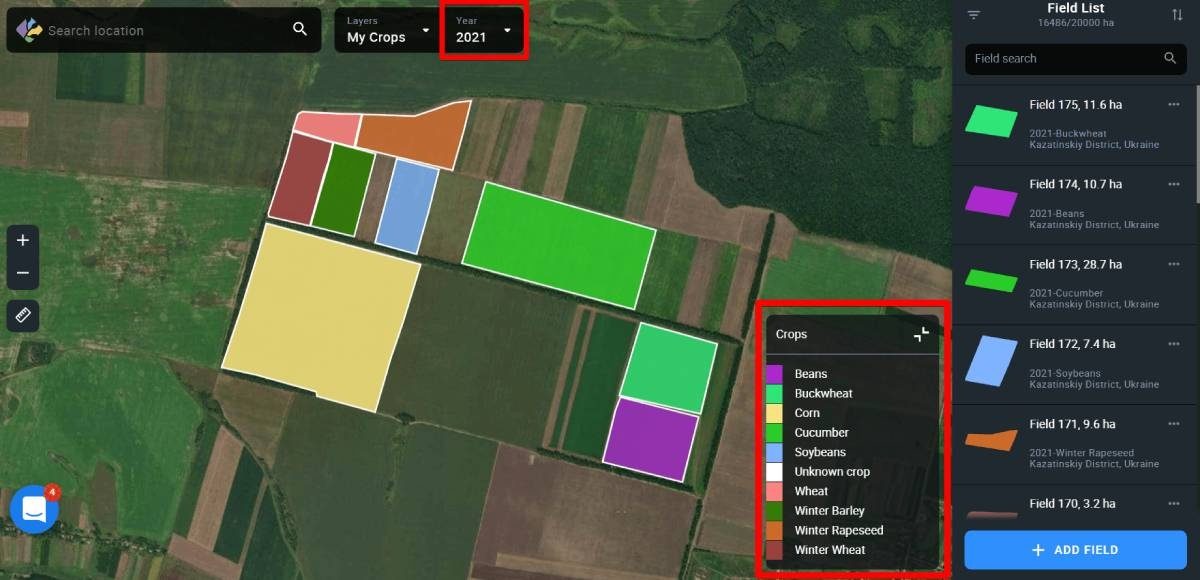


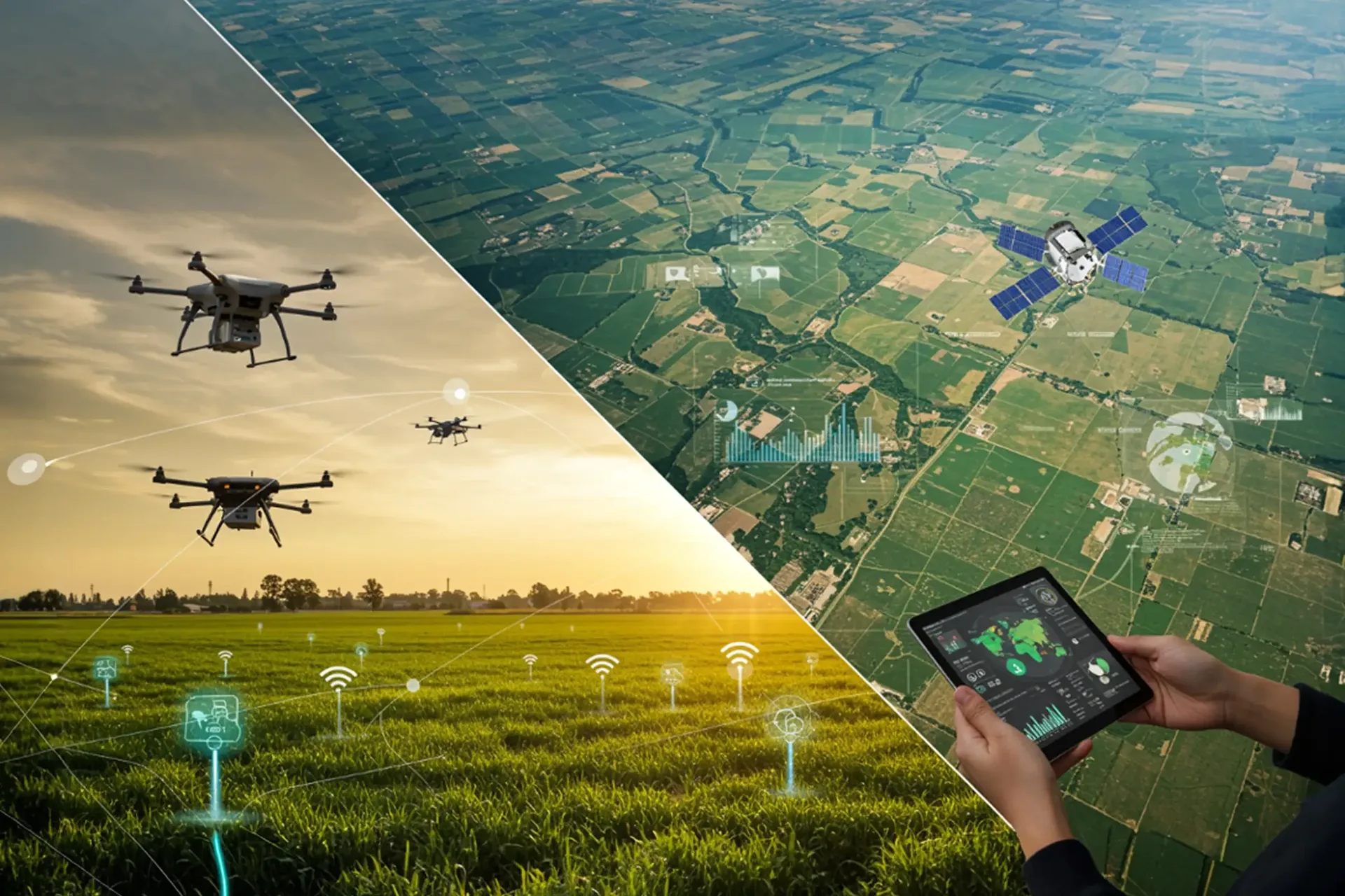
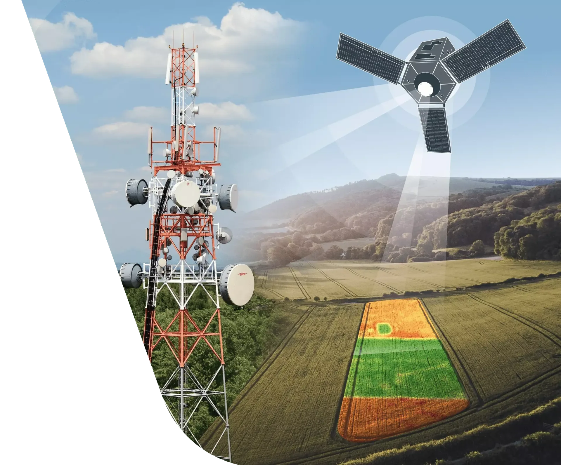
The data layers that power Akasha
Akasha is not a single dataset — it is a carefully curated stack of geospatial, spectral and weather intelligence layers, stitched together through agronomic workflows and designed to extend to sensors and institutional data as deployments mature.
Satellite Imagery Streams
Multi-source optical, radar and aerial imagery tuned for agricultural monitoring — open the CIDSA Satellite Finder to browse, filter and compare every supported source.
Open the satellite finderVegetation Analytics
A full suite of indices (NDVI, NDWI, MSAVI, EVI, NDRE, LAI) computed on-demand at field and regional scale.
Weather Intelligence Layers
Current conditions, forecasts and rainfall trend context, fused with field location to drive operational decisions.
Geospatial Field Boundaries
Standardized, geotagged field geometries and management zones — the foundation for all downstream analytics.
Advisory Intelligence Workflows
Rule-based and AI-assisted pipelines that turn analytics into crop-specific, localized recommendations.
Future-Ready Integrations
Extensible architecture ready for on-ground sensors, institutional data systems and partner analytics.
Crop-by-crop, season-by-season, region-by-region
Representative impact scenarios showing how Akasha supports monitoring, advisory and research across major crops and institutional contexts.
Paddy Monitoring Across the Season
Field-level NDVI trajectories, sowing progress tracking, and late-season stress signals supporting timely advisories during Kharif.
Wheat Condition Monitoring
Rabi wheat tracked from emergence to grain fill using EVI and NDRE, with frost-risk overlays during critical growth windows.
Sugarcane Stress Analytics
Long-cycle sugarcane canopy monitoring with water-stress mapping and variable-rate zone guidance for irrigation.
Horticulture Advisory Support
Dense-canopy EVI tracking and weather-linked alerts tuned for orchard and plantation crops to guide spray and harvest planning.
District-Level Rainfall & Crop Planning
Rainfall trends and crop-wise acreage intelligence combined into district dashboards for planning, risk and response.
University & Research Deployments
Time-series indices and field-level archives exported into research pipelines to validate agronomic models and publish findings.
Voices from the field, research labs and programs
Perspectives that reflect the kinds of outcomes Akasha is designed to enable across institutional agriculture. Placeholder quotes — to be replaced with live engagement as deployments mature.
Akasha gives us a validated, field-level geospatial baseline — from index trajectories to boundary-aligned archives — that our team couldn't easily assemble on its own.
University Research Lead
Agricultural Sciences — Research Centre
Having all member fields on one map, with weekly crop health and weather views, has changed how our collective plans spraying, irrigation and harvest windows.
FPO Coordinator
Farmer Producer Organisation
Advisories are meaningful only when they are localized and crop-specific. Akasha lets our officers send the right guidance to the right block, at the right time.
Agri-Extension Expert
State Extension Network
The ability to mix satellite monitoring, weather intelligence and GIS field records in a single dashboard has materially strengthened our program reporting.
Digital Agriculture Program Manager
Institutional Program Office